5/7/12
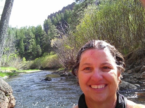
This morning, just after successfully lighting my stove (only took TWO tries this time) to make hot water for oatmeal and coffee, a lone backpacker entered my field of vision from the right, the direction I did NOT come from last night. Zoloft, of course, spotted her right away and ran towards her barking in her low-bark way, which the hiker thought was aggressive but I reassured her that no, all she wanted was a belly rub and, true to form, Zoloft rolled over for one and the hiker had no choice but to give her one. She was a woman named Barbara Nash, originally from Cleveland, Ohio, who took early retirement from Verizon and now lives in Washington D.C. who has been walking the Appalachian and Pacific Crest Trails (done with those) and came to the Mexican border with a male friend (who decided he didn’t like it and went home yesterday) to start walking the Continental Divide Trail from south to north. She appears to do the walking intermittently, five days at a time… (Beep! Two Forest Rangers just drove by). Anyway, we talked and she wrote her info in my black book so I can tell her sister and ex-walker friend that she was okay if I get phone or Internet service before she does. Apparently, the hike so far was disappointing because the trail was hard to find and you can easily lose yourself in a canyon and the lack of water is a problem. and ow, since her friend deserted her, she was worried about being alone. She was going to make her way to Silver City, NM, and go home from there. Her trail name is Late Start, which she picked because she gets up late and is late for things but has become a moniker more now because she started this hiking later in life than most people – she’s 61 now. After talking, it seems we might run into each other in two or three days at the Gila Cliff Dwellings where I’m thinking of going next.
Zoloft’s, Rio and I finally left camp at 12:30 or so, intending to take a “moderate ” ride but had two false starts. First, I went back to camp to get the tripod then, Wed gone half a mile or so and discovered my map had become detached from the saddle which I had no choice but to return to find. we went on Trail 705 which goes out of the Aeroplane Mesa Campround and has a sign that says “Horse Trail” next to it. A note on signs: This legible sign I found to be an exception all day long. The few signs I saw during the day were hard to read, few and far between, and easy to miss if you were several feet off the trail.
The first part of the ride was delightful. Since we were at 8,000′, it was cool and there was a solid breeze. We crossed a high plain with grass (very dry),cedar and a few ponderosa pine. Rio could get into a running walk for part of the trail because it has only intermittent rocks and a lot of sand and dust. the weather was in the low seventies and I started the ride with my canvas jacket on. After several miles we started the descent into the canyon headed towards the Middle Fork of the Gila River. It soon became steep and rocky and I dismounted and took off my jacket as it was warming up and in the canyon we were sheltered from the breezes on the Mesa. the route has many switchbacks, was quite narrow, very rocky, and had steep drop-offs. We’d been going down about 15 minutes when I realized I hadn’t secured my jacket to the saddle and it had fallen off. Being my favorite riding jacket and knowing I wouldn’t be returning this way, I tied up Rio and Zoloft and hiked back UP, with frequent stops to catch my breath until I found the jacket and returned to my travel companions. Along the way I marveled at the tough little wildflowers, real survivors in this tough landscape. The last time I’d dropped something on the Crest Trail in Lincoln National Forest I hadn’t tied Zoloft up and she’d followed me both ways and arrived back to Rio completely exhausted. This time I learned my lesson and she and Rio could both rest while I exhausted myself! we resumed our descent and arrived in the green valley with a beautiful stream of clear, cool, running water with green grass available door Rio to graze on. Tired and delighted by the green landscape, I decided to check the map, let Rio graze and eat a snack. I took the bit off of the halter bridle, decided to leave the lead line attached to the halter and let Rio eat. I sat on a log and consulted my map and the horse trail book. Oops, ten minutes later I looked up and, at first, couldn’t see Rio. I found her, walking straight UP the trail we’d just come down, evidentially deciding it was time to go home! I couldn’t believe she’d chose the vertical path over the green grass and running water, dropped my book and hustled up the path, huffing and puffing after him, which only made him go faster. Finally, he stepped on the lead rope and was stuck, head six inches from the ground, immobile. I unclipped the rope, pushed him off it it, re-clipped the line back on his halter, turned around on the precarious path, then headed back down to the river. It could have been a very, very long walk back to camp if I’d taken the lead off or if he’d never stepped on it! Lessons learned. I have to learn how to hobble him so he can more safely graze.
We resumed our ride and saw the sign for the turnoff to the Flying V trail, which was the one I’d started off deciding to follow. However, it headed across the river UP and I decided I’d much rather stay along the pretty river where it was easier going and Rio and Zenith could drink fresh water, so we followed the sign that said “Snow Lake 7 Miles” and continued along the riparian zone, with the trail criss-crossing the river. I estimated we’d get back to camp around 6pm. along the way, we met a solo backpacker who said he was a social worker from San Francisco. I asked him to take our picture, I took his and I asked him, “Why the Gila National Forest?” as this seemed an obscure place for someone from San Francisco to come to. He said he used to live in Albuquerque and was a history buff and that he’d hiked to the top of a nearby mountain where there’d been a fight between the Apaches and settlers that he’d climbed up to see the night before. There were two locked up cars in Aeroplane Mesa Campground and one was his. We said our goodbyes and each headed down the trail the other had just been on.
Wed gone half an hour or so when I saw Barbara Nash who jumped in fright as I came close and said hello! Zoloft had been in the river and her tummy was black with mud but she, nonetheless decided to jump up and Barbara and immediately located the snacks Barbara was about to eat, by smell. We talked some about the trail and she told me she’d met someone who was going to call her family tonight, so I was off the hook. I volunteered to go hiking with her sometime and she could call me if she needed a hiking buddy. We seemed to have a similar love for the outdoors and adventures in it. Having said our goodbyes, Rio, Zoloft and I went on down the beautiful trail, criss crossing the river and once finding a frog buried 8″ in the dusty sand which Rio’s step had uncovered. Its dark grey body matched the sand color perfectly. later, where the trail crossed an open field, I spotted a shoe, dismounted, picked it up and tied it to my saddle. It was a men’s size 11 and I figured it belonged to the history buff-social worker and I could return it to him at the campground later tonight. (He wasn’t there so it’s now in my trash bag.)
We’d gone a while (when I felt like we should have seen the trail going up the next canyon to the right) when the trail disappeared. I spent the next hour looking for it, crossing back and forth over the water through some dangerously rocky terrain to no avail. Getting worried about the sinking sun, I decided to go all the way back to where I’d seen a sign and re-evaluate our route. It was obvious that the map I had wasn’t detailed enough. the next time I come here I need to buy the larger-scaled maps of areas I want to explore. On the way back, I saw a trail going up a canyon in what I thought was the right direction and took it, quite nervous by this time as the shadows were lengthening and the sun could no longer be seen when the canyon walls blocked it. I wasn’t 100% sure I’d made the right choice and I knew there was a possibility we’d have to spent the night in the wilderness for which e were completely unprepared. Alleluia, it WAS the right trail and we eventually came out at the back of the damn that formed Snow Lake. On top of the dam was a sign with the the special trout limits for the Gillita River which we’d been following. I thought of my dad, avid fly fisherman he is. Only two trout per day could be taken.
We descended from the dam into the campground and down the road towards the turnoff to our campground. It was a very long four miles back and just dark when we got there. I had to open gates around the cattle guards preventing livestock like Rio from going to Snow Lake. Zoloft was so tired, I lifted her onto to the saddle in front of me (quite a trick, lifting her up then getting my tired ass back into the saddle behind her) and rode that way for about half a mile. Rio was amazingly OK with this but Zoloft is so long, it wasn’t an easy chore. It took us an hour and fifteen minutes to cover the ground and when we finally made it, I fed Zoloft and Rio then we all went to bed. I figured we’d walked and ridden 17 miles, all told. What a fun day but I already knew we’d be resting tomorrow.